
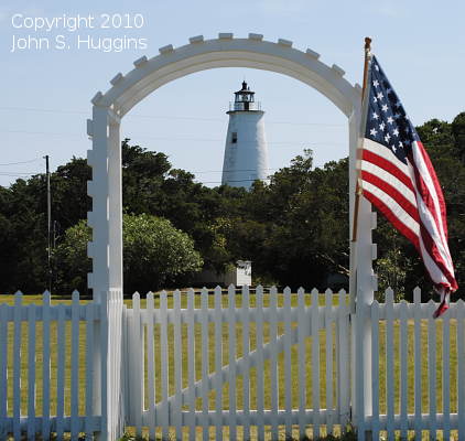
Ocracoke Island Light
ARLHS USA-561
ARLHS World List of Lights (WLOL)
Located in United States Of America Call Area
|
| Ocracoke Island Lighthouse Copyright 2010 John S. Huggins |
|
| ||||||||||||||||||||
This record modified August 18, 2010 - Feedback to the WLOL Maintainer
| Amateur radio activity for this Lighthouse | |||
|---|---|---|---|
| Start Date | End Date | Callsign | Notes |
| 2021-10-11 | 2021-10-15 | WB5K/4 | CW and maybe some digital. |
| 2016-05-29 | 2016-05-29 | KD3CQ/P | |
| 2011-08-06 | 2011-08-06 | W3MTP/4 | |
| 2010-07-25 | 2010-07-25 | N3AO | |
| 2001-06-02 | 2001-06-02 | KU4OJ | |
The information contained within the ARLHS World List of Lights is Copyright 2003-2026 ARLHS, LLC.
Visit ARLHS for usage information.
Database HTML Rendering Programs, MySQL Schema and Web Site Content (excluding the actual lighthouse data)
Copyright 2006-2026 John Huggins
PHP/MySQL Database Engine: $Revision: 1.91 $
Lighthouse Display Program: $Revision: 1.50 $


