
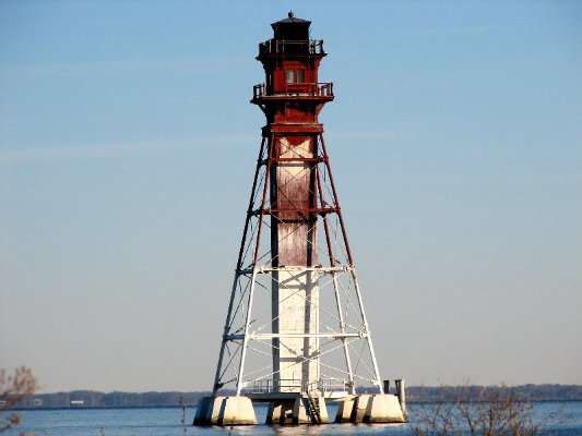
Craighill Channel Lower Range Rear/Millers Island Light
ARLHS USA-199
ARLHS World List of Lights (WLOL)
Located in United States Of America Call Area
|
| Craighill Chan. Lower Rear Range Light Copyright 2007 Jim KA3UNQ |
|
| ||||||||||||||||||
This record modified March 25, 2014 - Feedback to the WLOL Maintainer
| Amateur radio activity for this Lighthouse | |||
|---|---|---|---|
| Start Date | End Date | Callsign | Notes |
| 2021-12-28 | 2021-12-28 | KB3K/P | Christmas Lights event |
| 2020-05-29 | 2020-05-29 | KD3CQ/ | |
| 2019-11-03 | 2019-11-03 | KB3K/P | |
| 2017-02-27 | 2017-02-27 | K4VDX/P | |
| 2012-01-28 | 2012-01-28 | KA3UNQ | |
| 2010-12-21 | 2010-12-21 | KD3CQ/ | |
| 2008-03-22 | 2008-03-22 | KA3UNQ | |
| 2008-01-05 | 2008-01-05 | KA3UNQ | |
| 2004-12-05 | 2004-12-05 | KD3CQ | |
The information contained within the ARLHS World List of Lights is Copyright 2003-2026 ARLHS, LLC.
Visit ARLHS for usage information.
Database HTML Rendering Programs, MySQL Schema and Web Site Content (excluding the actual lighthouse data)
Copyright 2006-2026 John Huggins
PHP/MySQL Database Engine: $Revision: 1.91 $
Lighthouse Display Program: $Revision: 1.50 $


