ARLHS

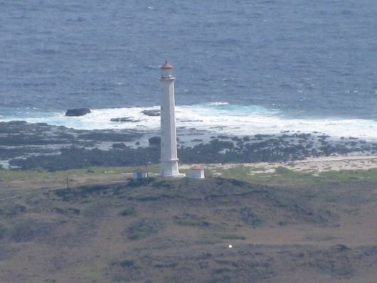
Kalaupapa (Molokai) Light

ARLHS HAW-006

ARLHS

ARLHS World List of Lights (WLOL)


Located in Hawaii Call Area

HAW-006 - Copyright 2009 KH7C
HAW-006
Copyright 2009 KH7C

Add a photograph

Details
Also Known As:
ARLHS HAW 006, HAW-006, HAW 006, Moloka'i
State or Province Hawaii
Lighthouse Coordinates
(DO NOT USE FOR MARINE NAVIGATION)
21.20957, -156.96971
21° 12.574' N, 156° 58.183' W
21° 12' 34" N, 156° 58' 11" W
Map Link - KML
Maidenhead Coordinates
aka 'Gridsquare'
BL11mf
Islands On the Air Info. OC-019, Hawaiian Islands, KH6,7
Structure removed, relocated, destroyed or otherwise lost? no
Listed in the World List of Lights since
2006-06-01
Admiralty G7292; USCG 6-28575.

This is the tallest U.S. Pacific lighthouse.

http://www.unc.edu/~rowlett/lighthouse/hi.htm

http://www.lighthousefriends.com/light.asp?ID=137
Google Map in New Window
Red Lighthouse Map Icon
Approx. Location
yellow Lighthouse Map Icon
Location Report Received
Green Lighthouse Map Icon
Location Verified

Circle shows 1000m radius from light

This record modified September 09, 2014. - Feedback to the WLOL Maintainer

Amateur radio activity for this Lighthouse
Start DateEnd DateCallsignNotes
2014-08-212014-08-25KH6BWGKH6BWG is the club callsign used for the activation. Operators were AH6NF, KH6FP, KH7C and KH7U.
2012-03-312012-03-31AH6NF, KH7U, WH6AA
2009-12-192009-01-03KH7C
Add a past, current or future operation.
Activation Start Date - YYYY-MM-DD
Activation End Date - YYYY-MM-DD
(only if multiple days)
Callsign of activator
Notes

The information contained within the ARLHS World List of Lights is Copyright 2003-2024 ARLHS, LLC.
Visit ARLHS for usage information.

Database HTML Rendering Programs, MySQL Schema and Web Site Content (excluding the actual lighthouse data)
Copyright 2006-2024 John Huggins
PHP/MySQL Database Engine: $Revision: 1.90 $
Lighthouse Display Program: $Revision: 1.50 $