
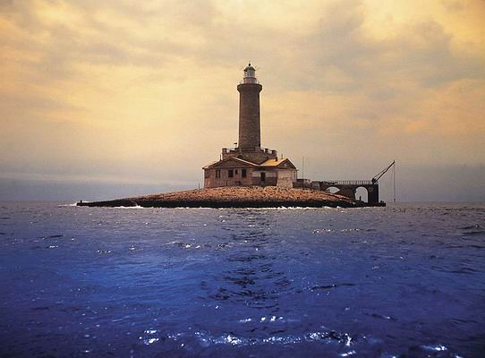
Porer (Islet of Pora) Light
ARLHS CRO-014
ARLHS World List of Lights (WLOL)
Located in Croatia Call Area
|
| LH Porer Copyright 2002 Franjo, 9A2MF |
|
| ||||||||||||||||
This record modified May 29, 2010 - Feedback to the WLOL Maintainer
| Amateur radio activity for this Lighthouse | |||
|---|---|---|---|
| Start Date | End Date | Callsign | Notes |
| 2014-09-18 | 2014-09-21 | 9A/IQ3VO | ARLHS CRO-014 Operators are I3VJW, IK3JBP, IK3SCB, I3JRF, IW3ICK, IZ3JKI, IW3ILP, IU3BXI. Activity will be on 80-10 meters using CW, SSB, RTTY, JT65A and PSK31, with two stations on the air. They also plan to be active with one station on 6 meters (WW Loc. JN64WS) using CW, SSB, MS, JT65A and EME. For EME and MS operations, skeds can be made through the ON4KST's Chat Web site. QSL via IQ3VO Bureau is preferred. |
| 2010-07-23 | 2010-07-26 | 9A/OM2FY | |
| 2003-07-13 | 2003-07-13 | 9A2MF/P | |
| 2001-08-13 | 2001-08-13 | 9A/DL1GEO | |
| 2001-07-31 | 2001-07-31 | 9A/ON5FP | |
The information contained within the ARLHS World List of Lights is Copyright 2003-2026 ARLHS, LLC.
Visit ARLHS for usage information.
Database HTML Rendering Programs, MySQL Schema and Web Site Content (excluding the actual lighthouse data)
Copyright 2006-2026 John Huggins
PHP/MySQL Database Engine: $Revision: 1.91 $
Lighthouse Display Program: $Revision: 1.50 $


