
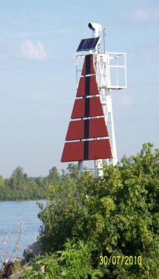
Limekiln Crossing Rear Range (Detroit River) Light
ARLHS CAN-1132
ARLHS World List of Lights (WLOL)
Located in Canada Call Area
|
| Limekiln Crossing Range Light Copyright 2010 Dave VE3DPJ |
|
| ||||||||||||||||||
This record modified August 03, 2010 - Feedback to the WLOL Maintainer
| Amateur radio activity for this Lighthouse | |||
|---|---|---|---|
| Start Date | End Date | Callsign | Notes |
| No Activations Known - Please add below | |||
The information contained within the ARLHS World List of Lights is Copyright 2003-2026 ARLHS, LLC.
Visit ARLHS for usage information.
Database HTML Rendering Programs, MySQL Schema and Web Site Content (excluding the actual lighthouse data)
Copyright 2006-2026 John Huggins
PHP/MySQL Database Engine: $Revision: 1.91 $
Lighthouse Display Program: $Revision: 1.50 $


